Most Commented
ARES MAP 2024 Build 2024.0.1.1179.9501 (x64) Multilingual


Description material

x64 | File size: 451 MB
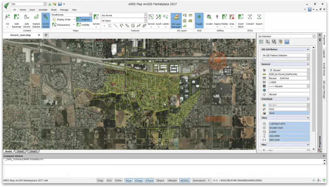
ARES® Map™ is a hybrid solution bringing together the intelligence of GIS contents and a full-featured DWG-based CAD system. Maps and floorplans created with ARES Map are saved natively in dwg but contain also smart GIS-enabled information associated to the entities.
ARES Map is powered by ArcGIS® Online from Esri, the world leader for GIS technologies and also based on ARES Commander™, Graebert's popular DWG-based CAD platform trusted by more than 7 million professionals.
Coordinate systems
-Add a GIS coordinate system to any DWG drawing from a list of systems provided by Esri to align the CAD file -with the rest of the world
-Choose from hundreds of projected, geometric or vertical coordinate systems
-If no coordinate system is assigned, ARES Map will assign automatically a default one based on the first GIS service loaded
Map services
-Connect to Esri's map servers and add free basemaps to your CAD drawings for any location on Earth: satellite -images, street maps, topographic maps.
-Add multiple maps and they will be positioned accurately with real-world coordinates
-Locate: Search any place or address to get the exact maps you want
-Manage the transparency and draw order of your maps to overlay or fade content
-Display the legend associated to a map service
-Map services can be saved and re-loaded or exported as raster images in your drawing
Feature services
-Connect to Esri's free feature servers or to your ArcGIS Online account to access web-based feature services
-ARES Map will create smart GIS-enabled CAD entities such as points, polygons, polylines, splines, ellipses and circles
-Manage the visibility of each layer to show or hide information as required
-Use ARES Map drafting tools to add, modify or delete entities
-New entities will become smart GIS-enabled entities if they qualify for the feature service definition
-Synchronize changes with the server to share your modifications
-Feature services can be saved and re-loaded
Attributes and labels
-Feature services entities do not contain only geometry but also attributes you can display and edit from ARES -Map's properties panel
-ARES Map maintains the integrity of your GIS information, attributes can only be modified following the at-tributes field definition and constraints defined by the GIS administrator: named values, range
-Labels help you annotate your drawings with text information extracted from the feature services attributes and stay in your drawing even when the feature service is not loaded
System requriements
OS:Windows 10 or higher
CPU:Intel Core i5 processor, AMD Athlon/Phenom™ x4 processor, or better
Space:1 GB free hard disk space depending on accessory applications installed
Memory:8 GB RAM
GPU:3D Graphics accelerator card with OpenGL version 3.2 or better
Display:Full HD monitor
Hardware:Wheel mouse, or 3D mouse
Screen :

What's New
HOMEPAGE
https://www.graebert.com/
Buy Premium Account From My Download Links & Get Fastest Speed.

Join to our telegram Group
Information
Users of Guests are not allowed to comment this publication.
Users of Guests are not allowed to comment this publication.
Choose Site Language
Recommended news
Commented


![eM Client Pro 9.2.1735 Multilingual [Updated]](https://pikky.net/medium/wXgc.png)


![Movavi Video Editor 24.0.2.0 Multilingual [ Updated]](https://pikky.net/medium/qhrc.png)

