Most Commented
Real-World GIS


Description material

Real-World GIS
Language: English | Size:713.94 MB
Genre:eLearning
Files Included :
01 - Need help with your GIS projects.mp4 (3.58 MB)
MP4
02 - What you should know.mp4 (875.37 KB)
MP4
01 - Where is the GIS data.mp4 (5.07 MB)
MP4
02 - How to consider the scale of GIS data.mp4 (6.73 MB)
MP4
03 - What spatial data are already in ArcGIS.mp4 (12.94 MB)
MP4
04 - How to get local and state GIS data.mp4 (7.5 MB)
MP4
05 - How to get the USA national map data.mp4 (11.78 MB)
MP4
06 - How to get census GIS data.mp4 (10.67 MB)
MP4
07 - How to get Earth Explorer data.mp4 (56.79 MB)
MP4
08 - How to bring hosted GIS data into ArcGIS.mp4 (7.78 MB)
MP4
09 - Challenge Get GIS data for a specific geography.mp4 (656.96 KB)
MP4
10 - Solution Get GIS data for a specific geography.mp4 (4.28 MB)
MP4
01 - Understanding GIS data types.mp4 (4.99 MB)
MP4
02 - Mastering vector GIS data.mp4 (20.31 MB)
MP4
03 - Mastering raster GIS data.mp4 (13.47 MB)
MP4
04 - How to choose the right GIS data formats for Projects.mp4 (10.62 MB)
MP4
05 - Challenge Vectorization vs rasterization.mp4 (814.88 KB)
MP4
06 - Solution Vectorization vs rasterization.mp4 (7.34 MB)
MP4
01 - How to understand the latitude, longitude, and scale.mp4 (16.67 MB)
MP4
02 - What is a developable surface.mp4 (5.81 MB)
MP4
03 - Using geoids, spheroids, and datums in GIS.mp4 (8.79 MB)
MP4
04 - Mastering projections in GIS.mp4 (26.99 MB)
MP4
05 - Challenge On-the-fly projection vs project.mp4 (980.64 KB)
MP4
06 - Solution On-the-fly projection vs project.mp4 (11.06 MB)
MP4
01 - Geospatial data collection basics.mp4 (3.61 MB)
MP4
02 - How to create a spatial database from coordinates.mp4 (24.8 MB)
MP4
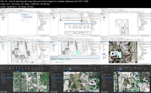
03 - How to add scanned map data and drone imagery to a spatial database.mp4 (59.71 MB)
MP4
04 - How to collect GIS data using ArcGIS Survey123.mp4 (26.55 MB)
MP4
05 - Challenge Georeference master.mp4 (980.93 KB)
MP4
06 - Solution Georeference master.mp4 (37.75 MB)
MP4
01 - What is ArcGIS Online.mp4 (22.86 MB)
MP4
02 - How to bring data into ArcGIS Online.mp4 (13.95 MB)
MP4
03 - How to build web maps from ArcGIS Pro.mp4 (55.17 MB)
MP4
04 - How to make an online mapping application.mp4 (17.78 MB)
MP4
05 - Challenge Make an online mapping application.mp4 (797.37 KB)
MP4
06 - Solution Make an online mapping application.mp4 (27.84 MB)
MP4
01 - Challenge Get the GIS data.mp4 (1.23 MB)
MP4
02 - Solution Get the GIS data.mp4 (7.07 MB)
MP4
03 - Challenge Visualize the GIS data.mp4 (755.42 KB)
MP4
04 - Solution Visualize the GIS data.mp4 (10.85 MB)
MP4
05 - Challenge GIS attribute data exploration.mp4 (668.2 KB)
MP4
06 - Solution GIS attribute data exploration.mp4 (8.13 MB)
MP4
07 - Challenge Isolate the GIS data.mp4 (512.49 KB)
MP4
08 - Solution Isolate the GIS data.mp4 (12.16 MB)
MP4
09 - Challenge Construct new GIS data.mp4 (627.04 KB)
MP4
10 - Solution Construct new GIS data.mp4 (13.65 MB)
MP4
11 - Challenge Analyze the GIS data.mp4 (765.21 KB)
MP4
12 - Solution Analyze the GIS data.mp4 (15.12 MB)
MP4
13 - Challenge Import GIS data into a geodatabase.mp4 (679.68 KB)
MP4
14 - Solution Import GIS data into a geodatabase.mp4 (19.59 MB)
MP4
15 - Challenge Convert GIS data.mp4 (969.78 KB)
MP4
16 - Solution Convert GIS data.mp4 (27.23 MB)
MP4
17 - Challenge Make a web map.mp4 (785.9 KB)
MP4
18 - Solution Make a web map.mp4 (13.29 MB)
MP4
19 - Challenge Make an online mapping application.mp4 (802.46 KB)
MP4
20 - Solution Make an online mapping application.mp4 (4.35 MB)
MP4
01 - What are the different types of GIS jobs.mp4 (7.29 MB)
MP4
02 - Where can you find GIS jobs.mp4 (7.06 MB)
MP4
03 - How can you master the GIS job interview Part 1.mp4 (4.42 MB)
MP4
04 - How can you master the GIS job interview Part 2.mp4 (6.35 MB)
MP4
01 - What are your next steps in GIS.mp4 (1.55 MB)
MP4


Join to our telegram Group
Information
Users of Guests are not allowed to comment this publication.
Users of Guests are not allowed to comment this publication.
Choose Site Language
Recommended news
Commented


![eM Client Pro 9.2.1735 Multilingual [Updated]](https://pikky.net/medium/wXgc.png)


![Movavi Video Editor 24.0.2.0 Multilingual [ Updated]](https://pikky.net/medium/qhrc.png)

