Most Commented
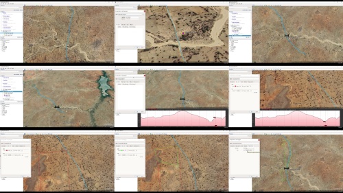
Google Earth Pro - Application to Engineering


Description material

Google Earth Pro - Application to Engineering
Language: English | Size:5.8 GB
Genre:eLearning
Files Included :
1 Installation Guide Download and Installation.mp4 (37.34 MB)
MP4
2 Google Earth Pro Interface.mp4 (28.02 MB)
MP4
1 Search module.mp4 (108.45 MB)
MP4
2 Getting direction between two pointslocations.mp4 (132.28 MB)
MP4
3 Place module.mp4 (55.51 MB)
MP4
4 Side bar - Layers.mp4 (265.94 MB)
MP4
1 Navigation with mouse.mp4 (77.54 MB)
MP4
2 Navigation with google earth navigation bars.mp4 (154.16 MB)
MP4
3 Street view.mp4 (41.7 MB)
MP4
1 Explore the view menu.mp4 (195.17 MB)
MP4
2 Tools and Options.mp4 (126.7 MB)
MP4
1 Creating folder.mp4 (81.67 MB)
MP4
2 Adding placemark.mp4 (233.32 MB)
MP4
3 Add path.mp4 (242.03 MB)
MP4
4 Add polygon.mp4 (87.83 MB)
MP4
5 Add image (Image overlay).mp4 (203.76 MB)
MP4
6 Record a tour.mp4 (95.01 MB)
MP4
7 Historical imagery.mp4 (102.41 MB)
MP4
1 3D polygon.mp4 (66.85 MB)
MP4
2 3D path.mp4 (94.33 MB)
MP4
3 Creating a map.mp4 (252.5 MB)
MP4
4 Import EXCEL file to Google Earth Pro.mp4 (121.1 MB)
MP4
5 Import TXT file to Google Earth Pro.mp4 (56.74 MB)
MP4
6 Export Google Earth map and image to AutoCAD.mp4 (229.98 MB)
MP4
7 Extract editable AutoCAD objects from Google Earth Pro.mp4 (98.26 MB)
MP4
1 Place marking points.mp4 (81.73 MB)
MP4
2 Defining road profile.mp4 (76 MB)
MP4
3 Road profile analysis.mp4 (213.79 MB)
MP4
4 Extracting route survey data.mp4 (233.4 MB)
MP4
5 Extracting route survey data B.mp4 (189.1 MB)
MP4
6 Convert extracted data to CSV format.mp4 (74.52 MB)
MP4
7 Convert LAT & LONG to Easting and Northing.mp4 (91.25 MB)
MP4
8 Import Google Earth data to Design Software CivilCAD Civil3D.mp4 (82.31 MB)
MP4
9 Adding site image.mp4 (176.82 MB)
MP4
1 Determination of catchment area for bridge, culvert, dam etc.mp4 (368.49 MB)
MP4
2 Pipe Network – Setting reservoir location.mp4 (176.44 MB)
MP4
3 Pipe Network – Junctions and pipe line.mp4 (167.85 MB)
MP4
4 Establishing pipe layout.mp4 (118.33 MB)
MP4
5 Exporting pipe layout to EPANET as base file.mp4 (243.92 MB)
MP4
6 Loading pipe layout to EPANET as base file.mp4 (33.47 MB)
MP4
1 3D modeling of structure for Environmental Impact Analysis.mp4 (109.39 MB)
MP4
2 Determination of site altitude and closest distance to sea.mp4 (177.8 MB)
MP4
3 Grid survey.mp4 (133.63 MB)
MP4


Google Earth Pro - Application to Engineering.z01
Google Earth Pro - Application to Engineering.z02
Google Earth Pro - Application to Engineering.z03
Google Earth Pro - Application to Engineering.z04
Google Earth Pro - Application to Engineering.z05
Google Earth Pro - Application to Engineering.zip

Join to our telegram Group
Information
Users of Guests are not allowed to comment this publication.
Users of Guests are not allowed to comment this publication.
Choose Site Language
Recommended news
Commented


![eM Client Pro 9.2.1735 Multilingual [Updated]](https://pikky.net/medium/wXgc.png)


![[PORTABLE] IObit Malware Fighter Pro 9.4.0.776 Multilingual](https://i.postimg.cc/QMW1mHcp/IObit-Malware-Fighter-Pro.png)

![Movavi Video Editor 24.0.2.0 Multilingual [ Updated]](https://pikky.net/medium/qhrc.png)

